History

After several holidays in hire boats, we were keen to take the next step and buy a boat of our own. We thought it would be many years before we could afford it, perhaps by way of a timeshare first. However in 2017 my mother Eileen Secker sadly died at the age of 89. Her legacy enabled us to think about getting our dream boat straight away, and after flirting with the idea of a new build we decided to find a second-hand one which suited us, and where someone more experienced had made sensible choices. Eventually we found the Silver Kroner, bought her and renamed her in honour of Eileen, who would have very much enjoyed the joke embodied in the name.
Showing posts with label Birmingham. Show all posts

Sunday, 22 November 2020

Behind the Scenes at the Museum

Saturday 12th September 2020

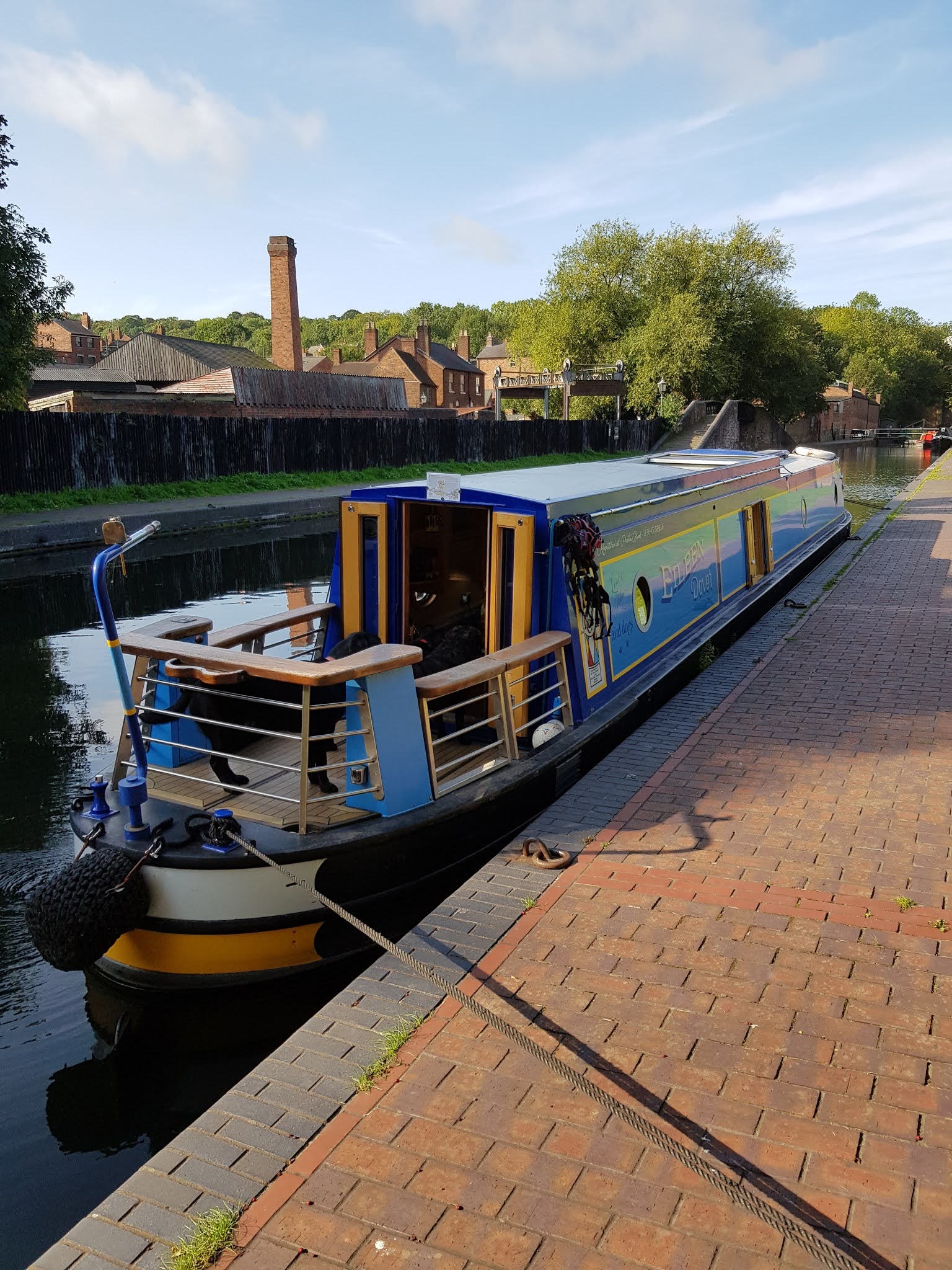
Although we were in the centre of England’s second city (the first is Manchester, obviously) we had a good night – it was noisier in Willington last Sunday, to be honest. We were in no rush to start – after the epic yesterday we had a fairly easy day planned, and we started by taking a walk around the centre with the dogs, up past Gas Street and the Mail Box. In the end we finally set off at about noon.

The New Main Line runs dead straight (and very wide) out of the centre of Birmingham towards the north west. The Old Main Line is still visible in this section in the form of several winding loops which head off to one side or the other. These are still navigable, and often used by the trip boats from the centre, and again we plan to come back and explore them all – for now we were taking the straight route out. At one point we saw a boat coming towards us, weaving from one side to the other. All was explained when we met and the guy asked if we were passing on the correct side, as he had only bought the boat that morning.

An odd feature of this stretch of the canal were four islands which we met at intervals. In each case they sat in the middle of the canal, leaving a channel each side just wide enough for a narrowboat. On the island were the remains of buildings, and docks, each the size of a lock – so just right for one boat. I assume that these have something to do with assessing tolls on passing traffic, from the time when canals were very big business.

After a couple of miles dead straight the canal curved slightly one way and the other. The loops of the old Main Line are still criss-crossing on either side, but here beyond Winson Green junction the loops are all disused. A mile further on, though, at Smethwick Junction, the Old Main Line proper takes off to the right, and goes up three locks. After running parallel for a mile or so it crosses over the New Main Line on an aqueduct at the same point as the M5 crosses over much higher up, quite a spectacular bit of engineering.

Just after passing these bridges we came to Spon Lane Junction, where a link from the Old Main Line comes down three locks and joined us from the right. At this point the canal curves slightly right, and there is another of those mid-stream islands. I was aiming to pass by on the right hand side – this is normal and also was the shortest route around the curve. However as I approached the narrow channel I was unhappy – it was overhung with vegetation on both sides and the water looked doubtful, so I put us unto reverse and stopped before we got far in. I reversed out and went around the island on the “wrong” side. Probably there was no issue with the other channel – there was no warning sign – but I just didn’t like the look of it.

At this point the canal started to get rather messy, with a lot of debris blown by the wind. We came around a corner to find a wide curve with most of the surface covered with stuff, everything from blown leaves to cans, barrels, bits of wood and unidentifiable remnants. It was no doubt caused by the way the wind was coming around the curve, but we took it very cautiously, not wanting to get anything around the prop, and also not wanting to ground on the outside of the bend, which looked very shallow. Happily we came to no harm and the New Main Line straightened out again for another couple of miles drawn with a ruler.

This was a dull and desolate section, through a flat and deserted landscape. The only interest was a number of branches heading off in each direction. First was the Wednesbury Old Canal, going north from Pudding Green junction. It climbs eight locks and then enters a complicated system of canals in the northern part of the Birmingham Canal Network. One arm comes down to meet the main line at Wolverhampton, while others head up as far north as Norton Canes – another branch winds up at Salford Junction under the M6, where we saw its mouth yesterday.

A little further on a short branch goes left, where it heads up three locks to join the Old Main Line. Another branch on the same side has a more interesting course – it goes under the Old Main Line and then into Netherton tunnel, 3000 yards long, which emerges into the Dudley canal and the southern parts of the Birmingham network. We will have plenty of exploring to do when we return.

As we headed along this stretch we noticed that the water in the canal was becoming clearer, so that we could see well down the bank below the surface, and eventually we found we could see the bottom, mostly green leafy weeds swaying in the currents as we passed. It was still clear when we came to the only locks of the day, the Factory locks at Tipton, a flight of three taking us up at last to the same level as the Old Main Line.

When we emerged from the top lock we turned sharp left and started to look for a mooring. Still enjoying the clear water we went through Tipton Green and passed the mouth of the Old Main Line, heading back east towards the city centre. We kept on a short way further though, along a dead end to the Dudley Black Country Museum.

Although I called it a dead end, strictly speaking the canal goes on through the Dudley tunnel, emerging further south on the Dudley Canal. However this has an extremely low profile, and normal boats will not fit in – it is really a part of the limestone mines, and special low boats were used to get the stone out. Some of these are still there, and the museum uses them to run tours into the mines. As far as normal canal boats are concerned though, this is the end of the line.


Mooring at the Dudley Black Country Museum

Water as clear as the Med

It was, however, an excellent spot to moor, by contrast with the rather uncertain suburb outside. There is a small basin, with public moorings for about four boats, and locked gates once the museum has closed – there was just one other boat there with us overnight. There is a CRT station there where we filled up with water, and we had moored up by mid afternoon. We took the dogs up the hill for a walk in a nice bit of rough woodland, and later on I walked up to a local Aldi for our supper. It was a bright sunny day and the water was clearer than ever – I believe that this is because of the limestone in the mines, so this is the clearest spot of all – it was like looking out of a glass bottomed boat in the Med. We had been spotting fish as we sailed along, and there were more than ever here, dozens and dozens of them in shoals, lots of little ones and up to about a foot long. Because the site was fenced in (to keep the public out) we were able to let the dogs off with no worries, and we spent a very peaceful evening.

TODAY: 3:00 HOURS. 9.2 MILES. 3 LOCKS.

Voyage: 53:40 HOURS. 96.4 MILES. 79 LOCKS.


Wednesday, 21 October 2020

Top of the Town

Friday 11th September 2020

Very conscious of the 27 locks ahead of us, we set off fairly early, about 8:15. Another consideration in my mind was a concern about availability of mooring in the centre of Birmingham – I didn’t want to arrive late and find that all the good spaces were taken, and have to moor somewhere insalubrious.

Within half a mile we started to travel through more built up areas, and soon came to the first of the Minworth locks. There are three of these, well spaced out, and really just a small worm-up for the rest of the day. Beyond the Minworth locks we were definitely passing through industrial areas, with factories in various states of dilapidation, pipe bridges and general grime. We came to a spot where a factory is actually built right over the canal, so that for several hundred yards you are running through a semi-tunnel made out of concrete pillars – there is open air out through the pillars on one side, but otherwise you are effectively underground.


Factory over the canal

Immediately after this we came to an electricity substation towering over us, with the biggest insulators and terminals I have ever seen. Now we were running alongside (and below) the M6, at Spaghetti Junction. Looking through the pillars below the motorway we could see Star City, an entertainment complex I have seen many times when driving past.


Spaghetti Junction

It may be Spaghetti Junction for motorists, but for a couple of hundred years before that this has been Salford Junction, the meeting of three canals. The Birmingham and Fazeley, which we were following, continues on towards the centre of the city. On our left, going south east, the Grand Union Canal starts from here. And to the right, going north west, is the Tame Valley branch of the Birmingham Canal Network (BCN). This looked narrow and little-travelled – many of the side branches of the BCN do not have many visitors, and are apparently often rather weed-choked and tricky to navigate. At some future time we will come down here and see if we can explore all the odd little back arms and loops, but for today we had a very specific objective, and we stuck to the main line.


Salford Junction below the M6

Loulie took the helm for a little while after the junction, and soon after, just past Cuckoo Bridge, she had a nasty shouting match with an unpleasant pair in a moored boat and dinghy, who seemed to feel that even tickover was too fast as we went past them.

We had now reached the bottom of the Aston flight, and started up. After the first three these locks are all very close together, and Loulie got out and worked them all, walking between them. She started to find that some of the locks we came to had their upper gates left open, which is a nuisance as she has to close them before starting to work the lock. It turned out that the boat ahead of us was another vlogger, called Robbie Cummings. He had two people helping him – one was going ahead working the locks, and the other was supposed to be following up. Sadly this bloke was also running a drone with which he was filming their progress, and he clearly could not spare the time from those duties to bother following canal etiquette. Loulie spoke to him, but it did not seem to have much effect. Fortunately we passed a number of boats coming the other way, and when that happened the locks were set in our favour.

On the Aston flight

Also more positive was a boat which was following us, one lock back. It seemed that this was a boat which had just been bought by a couple, and an experienced boater was helping them move it. He was working them into each lock and then leaving them to complete it while he came forward to help speed us on our way, by closing the gate behind me and allowing me simply to sail off. Without that help I was having to pull in and get off to close the gate, while Loulie went ahead to the next lock. Stuff like this makes a big difference when you are working up a long flight.

At the top of the Aston flight we came straight out at a T junction. To our left the Digbeth branch leads down six locks and two short tunnels to the Typhoo basin, and eventually links up with the Grand Union, coming down from Salford Junction. Again, next time we are here we will explore that alternative route. But today we were turning right, and along a pound of about half a mile to the bottom of the Farmers Bridge flight – thirteen locks which would take us to the end of our journey today. As we approached the bottom lock we saw Robbie Cummings moored on the towpath, so at least we would not be following him this time.

The Farmers Bridge locks are all close together, with very short pounds between them. Lock 12 (the second one we came to) is right below Snow Hill station, with huge concrete pillars and pools of water off to the side. Lock 9 is right underneath a towering office building. The whole flight feels as though it is in a deep canyon, with tall buildings rising on either side, and more coming into view straight ahead. We continued to have help from the boat behind us, and part way up the flight a couple of vlokkies appeared, which helped us on our way considerably. In the end we reached the top of the flight before three.

Loulie had asked one of the vlokkies about the best place to moor, and he had given her some advice. When we came out of the top lock we went ahead a few hundred yards then came out at a “roundabout” – Old Turn Junction. This whole area was completely unlike anything we had expected. Far from the seedy and run-down parts of Manchester which the Rochdale Canal passes through, this was the high-rent part of Birmingham. The canals are very wide, and the banks newly made, with stone sides and wide towpaths/footpaths, busy with shoppers, joggers and local residents. Large buildings overlook it – the Birmingham Arena, the Sea Life Centre and several new apartment blocks. The towpaths are lined with wine bars, restaurants and pubs – we could have moored outside Zizzi’s and had dinner there, if we had wanted to.

The roundabout where we had emerged was a small circular island in the centre of a wide area of water, with three canals heading off it, in addition to the B&F which had brought us out here. To our left was a stretch leading to Gas Street Basin, and beyond to the Worcester & Birmingham Canal. Straight ahead was the Old Turn itself – a short loop going ahead and then round to the right. And on the right was the beginning of the New Main Line of the BCN, which runs straight out of the city to the west. This was where we chose to moor, on the left hand side (there are towpaths on both banks), in front of some apartments and opposite the Arena. The neat stone banks were lined with rings, so we had no problem mooring, and there was plenty of space. It filled up a little later, but there was still loads of room in the various arms – my concerns earlier were entirely unfounded.


Bridge at Mail Box Turn

Birmingham & Worcs Canal going south

Local architecture


Gas Street Basin

Looking west towards Old Loop Turn

High end shopping

We took the dogs for a walk, and discovered one of the few downsides of this mooring – an almost complete absence of grass for the girls to tiddle on. Close to the boat the towpath was stone and tarmac, and further down there were just a few tiny scraps of grass behind an occasional tree. We walked over the junction and down past some flats, and eventually found enough green patches to allow them to relieve themselves.

After that I went on a longer walk, to get a few provisions and to scout for takeaways. I walked down past Gas Street Basin to Mail Box corner, where the canal turns ninety degrees right and heads off to the south. The “Mail Box” is a shopping mall – very high class, places like Gieves and Hawkes, Harvey Nicks and Emporio Armani. It also contains the offices of BBC Birmingham. I walked through there and down towards the Town Hall (a massive Victorian pile) and New Street Station, which is clad in an amazing sheath of curving reflective silver, more like a space ship than a railway station. Off in the distance I could see the Bullring and Selfridges, another bizarre curved silver building, this time covered in large hemispherical shapes.

Our plan was to have a Chinese takeaway, and Google Maps showed us Chinatown a mile or so away. We picked a restaurant and ordered on line, and I set off walking. I found it OK, but it was shuttered and under renovation – at that point I got a text message cancelling our online order. I was able to find another place close by and ordered, but on a busy Friday night I had to wait around for about 40 minutes before it was cooked. By the time I got back to the boat we were very ready to eat.

At bedtime we had the grass problem again – Bridget takes long enough at the best of times to do her last tiddle, and tonight I had to walk her up and down the towpath, over bridges and down side roads before she finally found a green spot that she liked.

TODAY: 6:45 HOURS. 8.0 MILES. 27 LOCKS.

Voyage: 50:40 HOURS. 87.2 MILES. 76 LOCKS.